From the courtyard
Use the motel as basecamp
Eight rooms, a courtyard, and 600,000 acres out the front door. What you do with a day here depends mostly on how much of it you want to spend driving, so that is how this is sorted: what you can walk to, what is a few minutes away, what is worth twenty, and what is worth the whole day.
On foot from the door
Christmas Circle and the shops and restaurants along Palm Canyon Drive are a walk from the door. In the cool months that is the whole evening: walk to dinner, walk back under the stars.
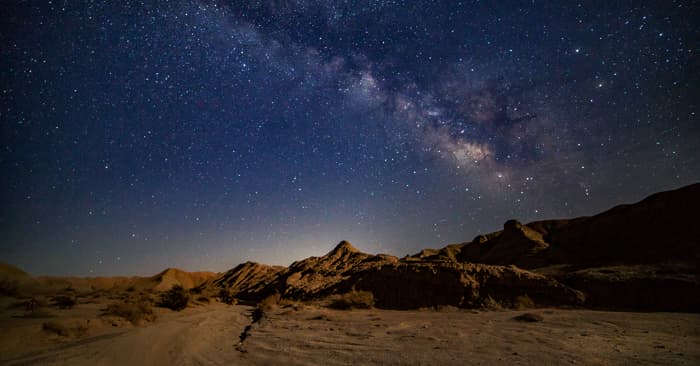
Dark-sky stargazing
Borrego Springs is an International Dark-Sky Community. New-moon weekends in winter are the clearest Milky Way you'll ever see.
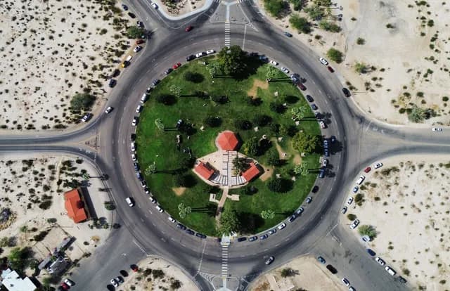
Christmas Circle
The town's central park — events, the farmers' market, and the meeting point for most of Borrego Springs' annual festivals.
The shops and restaurants along Palm Canyon Drive
BrowseShow me whereFrom the west side of Christmas Circle down to where Palm Canyon, Country Club and Ocotillo Circle meet. Most of the town's food and shopping is in those few blocks.
The Red Ocotillo
EatShow me whereOne of several walkable restaurants from the motel.
The Center
ShopShow me whereA little shopping plaza with Pablito's Bar & Grill, the Center Market, and Performing Arts Center.
The Mall
ShopShow me whereAcross the street from The Center: Calico's, Kendall's Cafe, Carmelita's, and Borrego Outfitters.
Anza-Borrego Desert Natural History Association
ShopShow me whereWildflower maps, field guides, and the kind of desert books you cannot find anywhere else. Worth going in even if you think you only want the map.
Borrego Springs Library
BrowseShow me whereAir conditioning, a chair, and something to read. An underrated move in the middle of a hot afternoon.
Pizza by the slice at the Mirage gas station
EatShow me whereExactly what it sounds like, and exactly as good as it needs to be when you get back from a hike at four in the afternoon.
A few minutes in the car
Close enough that you'll be there before the car's cooled down. Good for a morning out and back before it warms up.
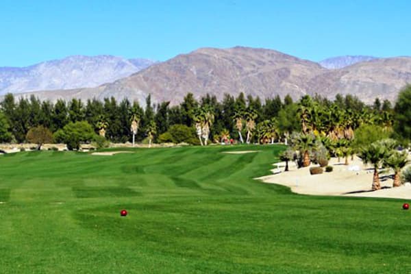
The Springs at Borrego Golf Course
Friendly 9-hole executive course inside The Springs RV Resort. Walkable, affordable, easy to fit between hikes.
~5 min drive
Rams Hill Golf Club
Tom Fazio-designed 18-hole course on the south side of town — semi-private, the most challenging round in Borrego Springs.
~7 min drive
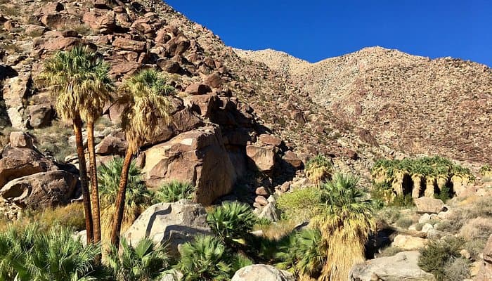
Borrego Palm Canyon
Three-mile loop into California's third-largest fan-palm grove. Bighorn sheep on the surrounding ridges.
~10 min drive
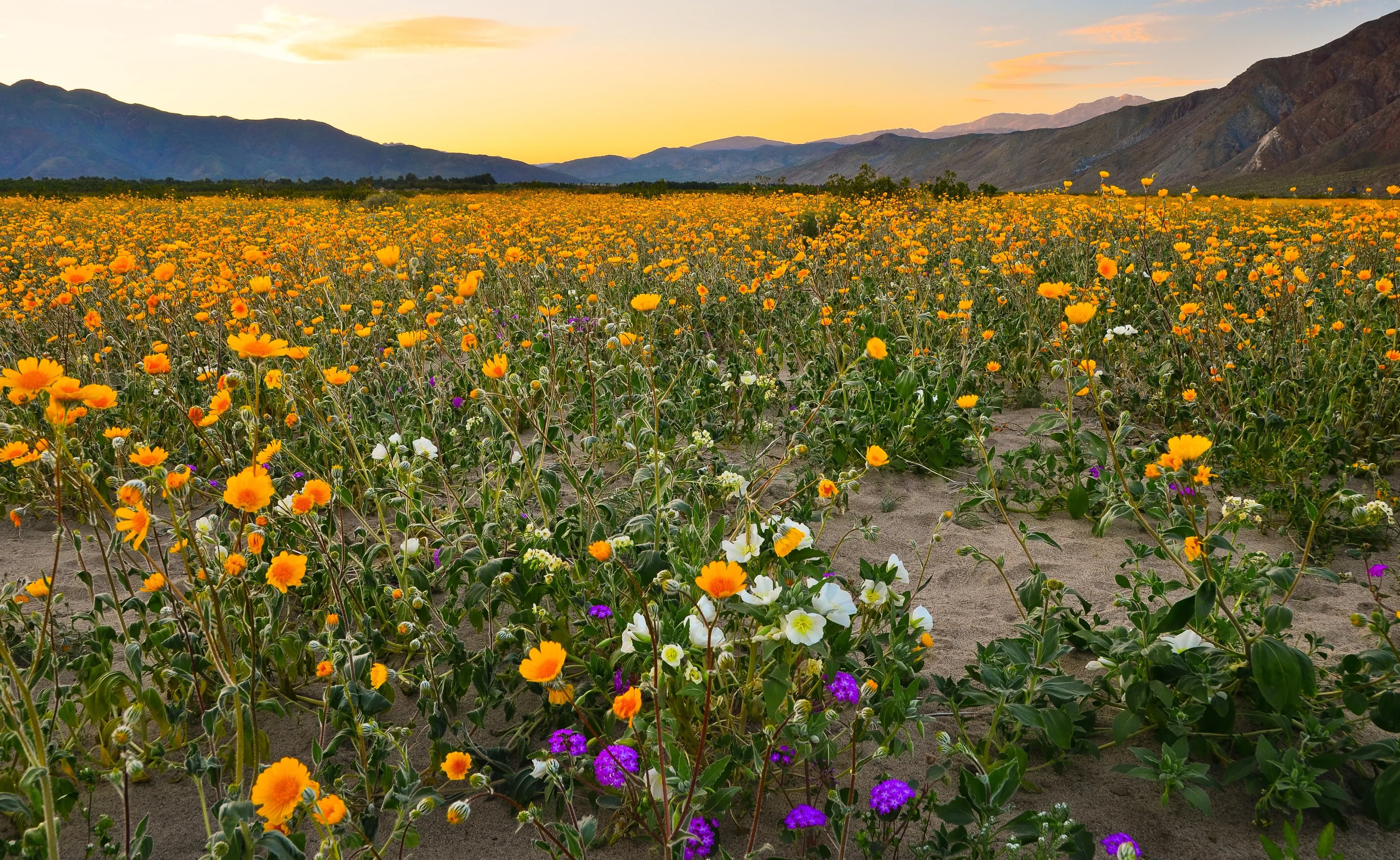
Wildflower superbloom
After a wet winter, the desert floor erupts in February and March. Brittlebush gold, sand verbena violet, ocotillo red.
5–20 min drive depending on bloom location
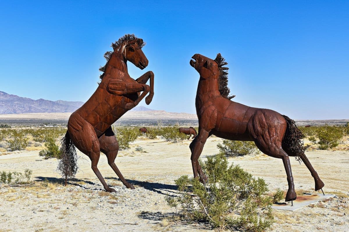
Galleta Meadows sculptures
Ricardo Breceda's life-sized metal animals — mammoths, raptors, a 350-foot serpent — scattered across the open desert.
5–15 min drive depending on sculpture
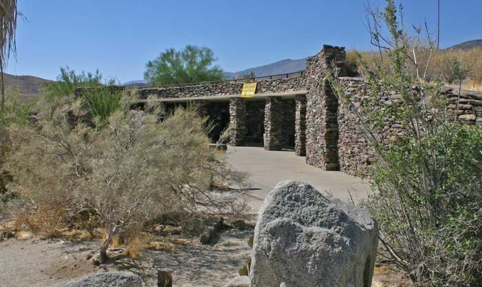
Anza-Borrego Visitor Center
Underground exhibits, wildflower updates, and trail maps — the right first stop on day one.
~10 min drive

Twenty minutes or so
Far enough to feel like an expedition, close enough to be back for a swim. This is most of the state park.
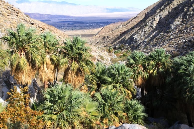
Hellhole Canyon
Four-mile out-and-back into a fan-palm oasis with a seasonal waterfall (Maidenhair Falls).
~12 min drive
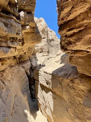
The Slot
Narrow slot canyon north of the badlands — squeeze through walls that close to a few feet apart.
~25 min drive
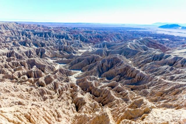
Font's Point
Drive-to badlands overlook. The Borrego Badlands light up gold, then pink, then deep violet at sunset.
~25 min drive (last 4 miles unpaved)
See them all: the Breceda sculptures
Ricardo Breceda's metal sculptures are scattered across the open desert around town: serpents, raptors, horses, a whole prehistoric menagerie. There is no single road that passes all of them, and that is the fun of it. Give yourself a couple of hours and treat it as a hunt.
Borrego Springs Road, north of town
Start hereThe easiest cluster to find, and the one with the sea serpent crossing the road.
Henderson Canyon Road
Start hereRuns east to west across the north end of the valley. Several of the biggest groupings are visible from the shoulder.
Big Horn Road and the south end
Start hereQuieter, fewer people, and worth the loop if you have already done the north.
Buy the sculpture map at the Anza-Borrego Desert Natural History Association shop in town before you set out. It marks them properly, it costs very little, and it will save you an hour of guessing.
A day out, back by dark
Three drives worth giving a whole day to. Each one ends back here, so you keep the room and the pool and do not pack a thing.
The Salton Sea and Salvation Mountain
East and south, out past the badlands
A full day. Roughly an hour each way, plus however long you stand there.
The Salton Sea and Salvation Mountain
East and south, out past the badlands
A full day. Roughly an hour each way, plus however long you stand there.
This is the strangest day you can have from the motel, and the one guests talk about afterwards. A sea below sea level that nobody planned, a mountain of painted adobe, mud that boils out of flat ground, and a town that half went home. Go with a full tank and more water than you think.
Salvation Mountain
Show me whereLeonard Knight's painted hillside outside Niland. Adobe, straw and thousands of gallons of paint. Smaller than the photographs suggest and far more affecting in person.
Sonny Bono Salton Sea National Wildlife Refuge
Show me whereStart at the visitor center. In winter this is one of the great bird stops in the state: snow geese, sandhill cranes, thousands of things on one body of water.
The Salton Sea shoreline
Show me whereStand on a beach made of fish bones and barnacles, 230-odd feet below sea level. The light late in the day is extraordinary.
The Mud Pots
Show me whereGryphons and mud volcanoes bubbling out of the ground near the geothermal field. They move over the years; the ground around them is soft and hot.
Bombay Beach
Show me whereA resort town the sea rose into and people left. It is now half ruin and half art installation, and the people still living there are the point of the visit.
Services are thin on this loop. Fill the tank before you leave town, take water, and do not plan on finding lunch where you hope to.
Julian, up the Banner Grade
West and up, climbing out of the desert
Half a day at a gentle pace. About an hour up.
Julian, up the Banner Grade
West and up, climbing out of the desert
Half a day at a gentle pace. About an hour up.
The drive is the reason to go. You leave the desert floor, wind up Banner Grade through rock and scrub, and arrive in a mountain town with pine trees and apple pie about four thousand feet higher than you started. It is genuinely a different climate; take a jacket even when it is warm here.
Banner Grade
Show me whereThe climb itself. Tight, scenic, and steady. Pull out where it is safe and look back at where you came from.
Julian
Show me whereGold-rush main street, pie in every other window, and a real change of air. Easy to spend three hours without planning to.
The grade is narrow and winding with few passing places. In winter Julian can have snow while Borrego Springs is in shirtsleeves, so check before you go.
Palomar Mountain, by way of Ranchita
West on S22, over the top
A full day if you go all the way to the observatory.
Palomar Mountain, by way of Ranchita
West on S22, over the top
A full day if you go all the way to the observatory.
The other way out of the valley, and the more dramatic one. Montezuma Valley Road climbs the wall of the basin in a series of switchbacks that locals call the Glass Elevator, with the whole desert floor falling away behind you. Ranchita sits at the top. Keep going and you reach Palomar and one of the most famous telescopes in the world.
The Montezuma Grade on S22
Show me whereThe climb out. There are pull-outs near the top where the view back over the badlands and the Salton Sea is the best in the county.
Ranchita
Show me whereA high-desert crossroads with a famous yeti and not much else, which is most of its charm. A good place to stop and get out.
Palomar Mountain and the observatory
Show me wherePines, cool air, and the Hale Telescope under its dome. Check the observatory's own hours before committing to the drive up.
This is a long climb with real elevation change. Check your brakes and your fuel before starting, and confirm Palomar's opening hours yourself on the day.
Ask Robin first
She lives onsite, she has hiked all of it, and she knows what is blooming, what is closed, and which road washed out last week. This page is a starting point. She is the actual concierge.